The first known map of Meadowbrook neighborhood was published in the paper 1936 to socialize the vibe, and here it is overlayed with a map of the current roads. As a reminder, click to enlarge the images:
and this is one with satellite imagery of the houses today
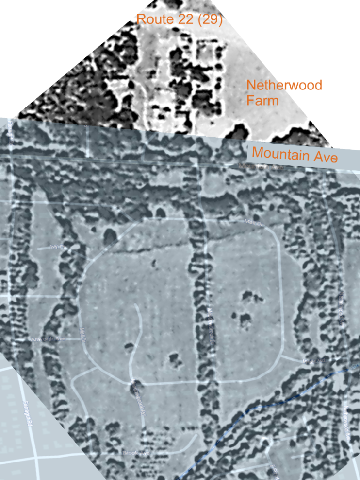
Also tried this with a 1931 aerial map showing the Netherwood farm.
And, much prior to the Netherwood (Johnston/ Mali) Estate, the 1862 map when it was the Berckmann Farm; note at the bottom of the image is the barely extant stream, "Long Meadowbrook" which is today at Milt Campbell Field... named after the first Black American to win the gold medal in the decathlon of the Summer Olympics 1956, neat!
Anywho, decided to try this cheeky layering of maps, because as the legend goes, the estate's riding trails are today the roads in the neighborhood but really it was FHA mandates for topography...
Ironically the FHA didn't like grids or lines, and yet instead of the map drawing depicting a two headed cul de sac monster, they instead continued using one straight riding trail in the middle of the Estate and peppered cul de sacs with some arterial roads on one big circle. 
Highlighted in blue circles are the "missing" cul de sacs
Only one cul de sac, Ivy Place, was built... Thistle Lane was at least mapped off of Mountain Ave (top right of the image) but never materialized, unlike Abbey Ct, Avon Place, and Stratford Circle which were never added beyond this initial 1936 map
though they were erroneously included in Sanborn Fire maps after ~15 years of not existing. 
Phew, that's a lot of layers!