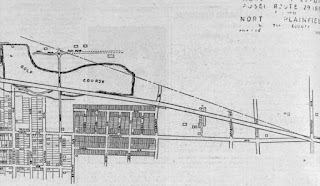
A few early ads indicate where the Meadowbrook neighborhood entrances were - remember, this was an undeveloped Estate and Farm; there wasn't a nearby shopping center or other homes to reference as shown in this link to a bird's-eye map view today.
This early ad below has a landscape photo, which a keen viewer suggested might have been the entrance gates on Route 29, which is Route 22 today. I had thought because the ads referenced Route 29 and Mountain Ave, that the ads meant an area what today is a traffic signal cluster of jug-handles and merge lanes.
But our keen viewer highlighted a now developed section of homes where instead that Gate Entrance might have been, before the aforementioned cluster-intersection existed.... so to the aerial photo time machine I went to do some compare and contrast.
And while not proof positive, it sure enough appears there was an entrance construction on what today are homes, but back then were remnants of the former Netherwood Farm, that had a road that connected directly to Route 29, and which is today opposite the entrance to the Watchung Square Mall.
Above is a 1931 aerial view before the Netherwood farm was removed (1935) and where the gate entrance may have been constructed later.
Compared below to a 1947 aerial view when the neighborhood was still quite under construction 11 years after the Opening Day in 1936, but a clear indication of a perhaps a stone wall or gate?
Pretty neat stuff!
Oh, what is Route 29 you may be asking? Ironically, in 1929 (almost 100 years ago) this happened....


No comments:
Post a Comment